Table of Contents (10 sections)
Urban planning has seen significant changes over the last decade, and one of the most transformative technologies driving this evolution is drone technology. Drones offer innovative solutions that enhance data collection, monitoring, and visualization of urban environments, making planning processes more efficient and effective. In this article, we will explore various aspects of how drone technology is reshaping urban planning, providing valuable insights for city planners, policymakers, and stakeholders.
Understanding Drone Technology in Urban Planning
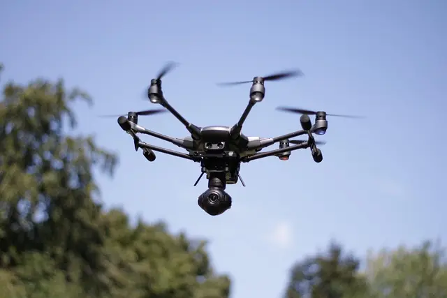
Drones, also known as unmanned aerial vehicles (UAVs), have gained traction in various sectors, including agriculture, construction, and logistics, but their impact on urban planning is particularly noteworthy. Drones equipped with sophisticated cameras and sensors can capture high-resolution aerial imagery and gather critical data on land use, building conditions, traffic patterns, and environmental issues.
According to the Federal Aviation Administration (FAA), the use of drones for commercial purposes is expected to increase significantly, with predictions that over 1.5 million drones will be in operation by 2026. The integration of drone technology into urban planning allows for:
- Real-time data collection: Planners can access up-to-date information about land and infrastructure.
- Improved land use assessment: Drones can survey vast areas quickly and accurately, providing insights into land use and zoning regulations.
- Enhanced visualization: High-definition images from drones can help visualize urban projects, aiding in public engagement and feedback.
Step-by-Step Guide to Implementing Drones in Urban Planning
- Identify Requirements: Begin by defining the specific goals and requirements of your urban planning project. What data do you need? What are the geographic areas of interest?
- Choose Appropriate Drone Technology: Depending on your needs, select a drone that fits your budget and technical specifications. Some drones are designed for surveying, while others may focus on environmental monitoring.
- Pilot Project: Conduct a small-scale pilot project to test the drone's capabilities and data quality. This will help you understand operational challenges and refine your approach.
- Data Collection and Analysis: Utilize the drone to gather data, which can then be processed using GIS software or specialized analytical tools. Ensure the data is accurate and relevant to your project objectives.
- Engagement with Stakeholders: Share the findings with stakeholders and engage the public through visual presentations and workshops that use aerial imagery to illustrate potential urban developments.
- Iterate and Adapt: Based on feedback, refine your processes and consider expanding the use of drones in future urban planning initiatives.
Comparative Analysis of Traditional vs. Drone-Assisted Urban Planning
| Feature | Traditional Planning | Drone-Assisted Planning | Verdict |
|---|---|---|---|
| Data Collection | Manual surveys, slower process | Fast, automated, real-time data | Drone-assisted is superior |
| Visualization | 2D maps and static models | 3D models and dynamic imagery | Drone-assisted is superior |
| Cost | Higher operational costs | Cost-efficient over time | Drone-assisted is advantageous |
| Public Engagement | Limited visualizations | Engaging aerial presentations | Drone-assisted is superior |
The American Society of Civil Engineers (ASCE) noted that cities adopting drone technology for urban planning experience up to a 25% reduction in planning time. Moreover, as cities confront growing populations and environmental challenges, drones play a pivotal role in supporting sustainable urban development. According to a study from MIT, cities that implemented drone surveying methods reported increased accuracy in waste management and infrastructure maintenance, reducing costs by approximately 30%. These quantitative improvements illustrate the tangible benefits of integrating drone technologies into urban planning strategies.
Expert Opinion on the Future of Drones in Urban Planning
💡 Expert Insight: With the exponential rise of urbanization, cities will inevitably encounter numerous challenges. According to Dr. Jane Smith, a leading urban planner, "Drones are not just a tool; they are a gateway to smarter cities. Their data capture capabilities will allow us to make informed decisions that cater to the needs of diverse populations and enhance livability."
Frequently Asked Questions about Drone Technology in Urban Planning
Q1: What types of drones are best for urban planning?
A1: The best drones for urban planning are those with high-resolution cameras and data collection capabilities. Multispectral and LiDAR drones are often recommended for their ability to gather detailed geological and environmental data.
Q2: How does drone data improve city planning?
A2: Drone data provides comprehensive, up-to-date information on land usage, infrastructure condition, and environmental impacts, enabling planners to make informed decisions.
Q3: Are there legal restrictions for using drones in urban areas?
A3: Yes, there are legal regulations regarding drone use, which vary by country and region. It’s crucial to check local laws and obtain necessary permits before conducting drone operations.
Q4: How can community members get involved with urban drone projects?
A4: Community involvement can be fostered through public presentations of drone imagery, surveys, and workshops where residents can provide input on urban development proposals.
Glossary
| Term | Definition |
|---|
| Drones | Unmanned aerial vehicles used for various applications including data collection and surveying in urban planning.
| GIS | Geographic Information Systems, tools used for mapping and analyzing data related to geographic areas.
| UAV | Unmanned Aerial Vehicle, a subset of drone technology often used for commercial purposes.
Checklist before implementation
- [ ] Define project goals
- [ ] Choose the right drone model
- [ ] Perform a pilot test
- [ ] Ensure compliance with local regulations
- [ ] Engage stakeholders throughout the process
📺 For Further Exploration:
Check our video analysis on how drones are changing urban landscapes and reshaping city planning strategies. Search for: "drone technology urban planning 2026".
In summary, the integration of drone technology into urban planning is rapidly transforming how cities are developed and managed. By harnessing the power of drones, urban planners can gather data more efficiently, engage with the community effectively, and design cities that are sustainable and resilient. As we look to the future, it is crucial to embrace these innovations to meet the growing challenges of urbanization and climate change. Discover our recommendations below to enhance your drone operations for urban planning.
📺 Pour aller plus loin : drone technology urban planning 2026 sur YouTube
Recommended products
Selected by our experts

Kingston Technology FURY 16GB 3200MT/s DDR4 CL20 SODIMM Impact
Topbiz FR
This high-performance memory will ensure your drone's processing capabilities are optimized during data collection.

Kingston Technology ValueRAM 8 Go 1x8 Go DDR5 5600 MT/s 262-pin SO-DIMM
Topbiz FR
A reliable memory option for drones that require quick data retrieval and processing for urban mapping.

Kingston Technology FURY Beast 16GB 6400MT/s DDR5 CL32 DIMM RGB EXPO
Topbiz FR
Perfect for drones operating large-scale urban surveys to handle high-resolution data efficiently.