Table of Contents (14 sections)
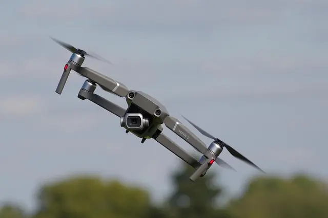
In the rapidly evolving landscape of technology, drone technology aerial surveys stand at the forefront of innovation. Drones have revolutionized the way data is collected, analyzed, and utilized in various industries, including agriculture, real estate, environmental monitoring, and infrastructure development. These unmanned aerial vehicles (UAVs) are equipped with sophisticated sensors and cameras that capture high-resolution imagery and geospatial data, making them indispensable tools in contemporary surveying practices.
Drones offer numerous advantages over traditional survey methods, such as reduced costs, faster data acquisition, and increased safety for operators. They can cover large areas in a fraction of the time, allowing for more efficient project completion. This article delves into the advancements in drone technology and its impact on aerial surveys, exploring innovative applications and the benefits associated with their use.
What is Drone Technology in Aerial Surveys?
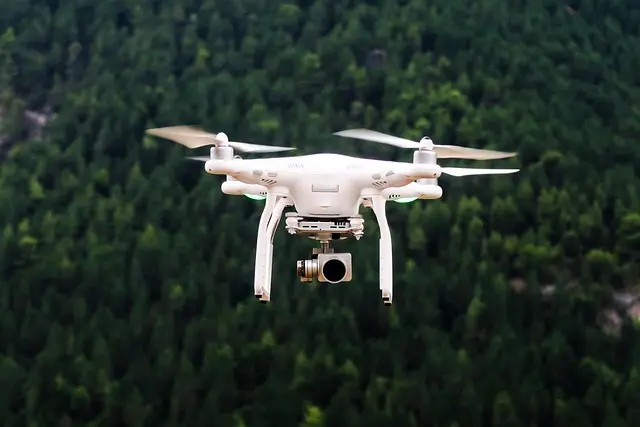
Drone technology refers to the use of unmanned aerial vehicles for various applications, including aerial surveys. These drones can be outfitted with various sensors, such as LiDAR (Light Detection and Ranging), cameras, and multispectral sensors, to collect diverse data types. In aerial surveys, drones provide a method to obtain real-time, accurate data regarding land topography, vegetation health, and infrastructure conditions.
The integration of GPS and other technologies has allowed drones to function autonomously, meaning they can follow predetermined flight paths and collect data without constant human input. Additionally, the imagery and information gathered can be processed using advanced software to create maps, 3D models, and other analytical outputs. This capability turns drones into powerful tools for professionals looking to enhance their surveying processes.
How Drones are Used in Aerial Surveys
Construction and Infrastructure
In industries such as construction and infrastructure, drones provide a systematic approach to monitor project sites more efficiently. They can execute periodic surveys to track the progress of construction projects, detect discrepancies, and facilitate inspections of hard-to-reach areas. For instance, drones can quickly assess structural integrity during inspections after severe weather events. This capability drastically reduces downtime and enhances safety by minimizing the need for personnel to enter hazardous environments.
Agriculture
In agriculture, drones play a vital role in precision farming. High-resolution imagery can be used to analyze crop health, assess irrigation practices, and plan pesticide applications more accurately. For example, a farmer can utilize drone technology to generate vegetation indices, which provide insights into plant health and growth patterns, allowing timely interventions that can maximize yield. According to a study by the University of California, drones have been shown to increase crop yield by up to 15% by fostering more efficient resource management.
Environmental Monitoring
Drones are also extensively used in environmental monitoring to assess biodiversity and track changes in ecosystems. They are invaluable in undertaking wildlife surveys, monitoring deforestation, and assessing the impacts of climate change. Their ability to cover vast areas and collect precise data ensures accurate assessments. For instance, organizations can deploy drones to capture images of endangered species, enabling conservationists to track their populations and habitats over time.

Milwaukee Leather 7.4V Men's True All Seasons Leather Jacket with Heated and Cool Technology
thewarmingstore.com


Advantages of Using Drone Technology in Aerial Surveys
- Cost Efficiency: Drones significantly reduce the costs associated with aerial surveys by minimizing equipment and manpower expenses.
- Speed: Drones can cover large areas in less time compared to traditional methods, enabling faster data collection and analysis.
- Safety: Reduced risk to surveyors working in hazardous conditions makes drones a safer alternative for aerial surveys.
- Data Quality: Drones equipped with advanced sensors provide high-resolution imagery that enhances the quality and accuracy of survey data.
- Environmental Impact: Drones have a lower environmental impact compared to traditional aircraft, which contributes to more sustainable surveying practices.
Comparing Traditional Methods with Drone Technology
| Criteria | Traditional Methods | Drone Technology | Verdict |
|---|---|---|---|
| Cost | High | Low | Drone Technology Wins |
| Speed | Slow | Fast | Drone Technology Wins |
| Data Resolution | Moderate | High | Drone Technology Wins |
| Safety | Medium | High | Drone Technology Wins |
By analyzing these criteria, it becomes clear that drone technology provides distinct advantages that can lead to more effective and efficient outcomes in aerial surveying.
Statistical Insights and Trends
According to recent market research conducted by Deloitte, the drone services market is projected to reach $63 billion by 2025, driven by increased adoption across various sectors. Furthermore, a report from the Federal Aviation Administration (FAA) indicates that there are expected to be more than 835,000 commercial drones operating in U.S. airspace by the end of 2026. This growth underlines the importance of drone technology in today’s economy and its integral role in aerial surveys.
Frequently Asked Questions
Q: How accurate are drone surveys?
A: Drones can achieve accuracy levels of up to 1-3 cm thanks to high-resolution sensors and GPS technology.
Q: What industries are utilizing drone surveys?
A: Industries such as agriculture, construction, environmental monitoring, and mining are leveraging drone technology extensively.
Q: Are drones safe to use for aerial surveys?
A: Yes, drones are designed with safety features and provide a safer alternative to manned aircraft, particularly in hazardous environments.
Q: How long can drones fly for surveys?
A: Most commercial drones can operate for 20 to 60 minutes on a single battery charge, depending on their payload and weather conditions.
Samsung Laundry Dryer with AI Control and Heat Pump Technology in White(DV25FG62B0BEA2)
samsung.com

Samsung Front Load Washer & Dryer Set with Vibration Reduction Technology+ and Sensor Dry in White(BNDL-1603912197302)
samsung.com

BISSELL CleanView with OnePass Technology Plus Upright Bagless Vacuum Sienna 3583
bissell.com
Conclusion
As the demand for precise and rapid data collection continues to grow, the application of drone technology in aerial surveys becomes increasingly vital. The advantages provided by drones, including cost savings, enhanced safety, and high-quality data, position them as transformative tools in surveying practices. With the potential for further advancements in drone capabilities, the future of aerial surveys appears to be bright.
💡 Advice from Experts: In the evolving world of UAVs, staying updated with the latest technologies and regulations is crucial for surveyors to maximize the benefits offered by drones.
📺 Resource Video
To explore the future of drone technology and its impact on aerial surveys, search for “drone technology advancing aerial surveying 2026” on YouTube.
Glossary
| Term | Definition |
|---|---|
| Drone | An unmanned aerial vehicle used for various applications, including surveying and mapping. |
| LiDAR | A remote sensing method that uses light in the form of a pulsed laser to measure variable distances to the Earth. |
| Geospatial Data | Information that is associated with a specific location on the Earth's surface. |
Checklist Before Purchase
- [ ] Determine your surveying needs.
- [ ] Assess the types of drones suitable for aerial surveys.
- [ ] Evaluate data processing software compatibility.
- [ ] Review battery life and range specifications.
- [ ] Ensure compliance with local regulations.
We have also selected several relevant products suited for these tasks, so explore our recommendations below.
📺 Pour aller plus loin : drone technology advancing aerial surveying 2026 sur YouTube
Recommended products
Selected by our experts

Clinique Redness Solutions Makeup Broad Spectrum SPF 15 With Probiotic Technology, Calming Honey - 1 fl. oz./30 ml
clinique.com

PLAUD Inc. Plaud Note AI Voice Recorder, Voice Recorder w/Case, App Control, Transcribe & Summarize with AI Technology, Support 112 Languages, 64GB
plaud.ai
Nonin Medical NoninConnect™ Finger Pulse Oximeter with Bluetooth® Smart Wireless Technology
concordhealthsupply.com
Nonin Medical NoninConnect™ Finger Pulse Oximeter with Bluetooth® Smart Wireless Technology
concordhealthsupply.com

Plaud NotePin AI Voice Recorder, Voice Recorder with Neck Strap Lanyard, Transcribe & Summarize with AI Technology, 64GB Memory
plaud.ai