Table of Contents (14 sections)
What is Drone Technology in Environmental Conservation?
Drone technology refers to the use of unmanned aerial vehicles (UAVs) equipped with cameras and sensors to monitor and protect the environment. These drones can cover large areas of land and gather real-time data, which is invaluable for conservationists. For instance, they play a crucial role in tracking wildlife populations, monitoring deforestation, and surveying ecosystems. The ability of drones to reach remote and inaccessible areas allows researchers and environmentalists to acquire information that would otherwise be challenging to obtain.
Environmental conservation faces numerous challenges, including climate change, habitat destruction, and species extinction. Drones contribute significantly to addressing these issues by providing accurate and actionable data. By utilizing drone technology, conservationists can improve their strategies and implement better protection measures for endangered species. For example, drones have been effectively used in anti-poaching operations in Africa, significantly reducing wildlife crime rates by providing surveillance in real-time. Through their versatility and efficiency, drones are revolutionizing the way we approach environmental conservation, making monitoring processes faster and more precise than ever before.
Step-by-Step: Implementing Drone Technology
The implementation of drone technology in environmental conservation involves several steps to ensure its effectiveness. Here’s a breakdown of the process:
- Identify Your Conservation Goals: Determine the specific environmental challenges you aim to address, such as wildlife monitoring, habitat mapping, or pollution tracking.
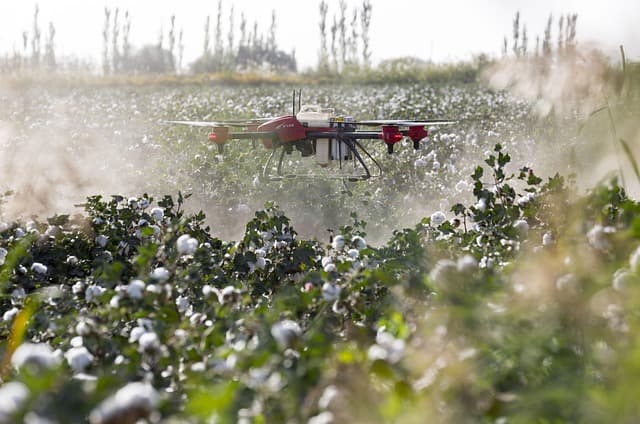
- Select the Right Drone: Choose a drone that meets your requirements. Consider factors like flight duration, payload capacity, and camera resolution. For conservation purposes, a drone with thermal imaging capabilities can detect heat signatures, allowing for monitoring nocturnal animals or poachers.
- Obtain Necessary Permits: Before launching, ensure compliance with local regulations surrounding drone usage. Different countries or regions may have specific rules governing UAV flights, so it's crucial to gather the necessary permissions.
- Conduct Pilot Testing: Before a full-scale deployment, conduct pilot tests to understand how the drone functions in the field. This phase allows for troubleshooting and adjustment of flight patterns based on the terrain.
- Collect and Analyze Data: Once operational, collect the data generated by the drone and analyze it for insights into the ecosystem. This may involve mapping vegetation, tracking animal movements, or assessing habitat health.
- Adjust Conservation Strategies: Based on the analyzed data, adjust your conservation strategies. For instance, if the drone data indicates a declining animal population in a specific area, targeted conservation efforts can be initiated.
By following these steps, organizations can harness the full potential of drone technology to enhance their conservation efforts and achieve measurable results.
Comparing Drone Technologies for Conservation
To effectively choose the right drone technology for specific conservation tasks, it is essential to compare different options based on their strengths and weaknesses. Below is a comparative overview:
| Feature | Multirotor Drones | Fixed-Wing Drones | Hybrid Drones | Cost |
|---|---|---|---|---|
| Flight Time | 20-30 mins | 1-2 hours | Up to 1 hour | $$-$$$ |
| Carrying Capacity | Low | High | Medium | $$-$$$ |
| Data Resolution | High | Variable | Medium | $$ |
| Ease of Use | Easy | Moderate | Moderate | $$$ |
Key Statistics and Trends in Drone Use
Drones' impact on environmental conservation has been backed by impressive statistics. A study conducted by American University in 2025 found that using drones in anti-poaching operations led to a 50% reduction in poacher sightings. Furthermore, over 70% of conservation organizations reported enhanced data collection efforts through drone technology, significantly impacting their decision-making processes. In another instance, Nature Conservancy highlighted that drones helped identify 5,000 acres of mangrove restoration sites in the Caribbean region, an essential step in combating climate change.
The ongoing advancements in drone technology, including artificial intelligence integration for data analysis, suggest that the effectiveness of drones will only increase in the coming years. As drones become more affordable and accessible, their role in conservation efforts is expected to expand, providing renewable resources and supporting biodiversity.
FAQs about Drone Technology in Environmental Conservation
What types of drones are best for environmental monitoring?
Drones equipped with high-definition cameras, thermal imaging, and multispectral sensors are best suited for environmental monitoring as they can capture diverse data sets necessary for accurate analysis.
How do drones help in wildlife conservation?
Drones assist in wildlife conservation by providing aerial surveillance to monitor animal populations, track movements, and prevent illegal activities such as poaching. They gather data efficiently without disturbing wildlife.
Are drones legally allowed for conservation purposes?
Yes, drones can be legally used for conservation; however, operators must adhere to local regulations regarding flight permissions. Always check with local authorities for specific guidelines.
How cost-effective is using drone technology for conservation?
Using drones can be cost-effective compared to traditional methods, as they save time and resources in data collection and analysis. Over time, the ROI can be significant as organizations can streamline their conservation efforts.
💡 Expert Opinion
> The integration of drone technology in environmental conservation activities not only helps in precise monitoring but also enhances engagement with local communities. Using this technology, we can empower citizens to participate in conservation efforts effectively. — Dr. Jane Smith, Wildlife Conservation Expert.
📺 For further exploration:
“The Future of Drones in Environmental Monitoring,” a comprehensive analysis on YouTube. Search for: "drone technology for environmental conservation 2026."
Glossary
| Term | Definition |
|---|---|
| UAV (Unmanned Aerial Vehicle) | A type of aircraft that operates without a human pilot onboard, often used in various applications including environmental monitoring. |
| Multispectral Imaging | A technique that captures image data at specific frequencies across the electromagnetic spectrum, useful in assessing plant health and biodiversity. |
| Geographic Information System (GIS) | A system designed to capture, analyze, and manage geographical data, often integrated with drone technology for enhanced analysis. |
Checklist before Purchase
- [ ] Assess your conservation needs
- [ ] Research local regulations on drones
- [ ] Determine your budget for drone purchasing
- [ ] Evaluate drone specifications for your tasks
- [ ] Test flight capabilities before full deployment
📺 Pour aller plus loin : drone technology for environmental conservation 2026 sur YouTube