Table of Contents (6 sections)
Introduction
In recent years, aerial surveillance drones have transformed how we perceive security and oversight in various sectors. From law enforcement policing to agricultural monitoring, these drones enable real-time data collection, enhancing operational efficiency and situational awareness. This article explores the revolutionary impact of drone technology on aerial surveillance systems, examining its applications, methodologies, and the future directions these innovations may take.
What Are Aerial Surveillance Drones?
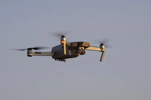
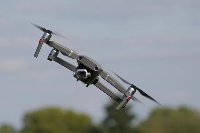
Aerial surveillance drones, often referred to as UAVs (Unmanned Aerial Vehicles), are remotely operated or autonomous aircraft designed specifically for surveillance purposes. These drones come equipped with high-resolution cameras, infrared sensors, and advanced data processing capabilities, allowing them to gather real-time information over vast areas.
Why Use Drones for Aerial Surveillance?
The use of drones offers numerous advantages. They are not only cost-effective compared to traditional manned aircraft but also capable of accessing hard-to-reach areas safely. According to a report from the Federal Aviation Administration (FAA), drone usage in aerial surveillance has increased by over 50% from 2020 to 2026, highlighting their growing prominence and acceptance in various industries.
Drones contribute to data accuracy and quicker response times in situations requiring urgent analysis, such as natural disasters or public safety incidents. Their ability to operate remotely mitigates risks associated with human operators, allowing agencies and organizations to make informed decisions swiftly.
How Drone Surveillance Works: Step-by-Step
Drone surveillance is a process that entails several steps, ensuring data is collected effectively and ethically.
- Planning the Mission: Before deploying a drone, operators must conduct a risk assessment and understand the surveillance objectives. This planning phase includes determining flight paths, camera angles, and ground control measures.
- Pre-Flight Checks: Operators ensure that drones are in optimal working condition. This involves checking batteries, sensors, and cameras to guarantee data collection will be seamless.
- Deploying the Drone: Drones are launched, following preset flight paths to capture necessary visuals and data. This phase requires operators to monitor the drones closely to handle unexpected situations.
- Data Collection: As the drone flies, it gathers data through its sensors. The collected imagery is transmitted back to a ground station in real-time or stored for analysis later.
- Post-Flight Analysis: After the mission, the data is reviewed, analyzed, and interpreted for actionable insights. Users can employ sophisticated software to enhance images or stitch them into 3D models for better visibility.
This streamlined methodology not only facilitates efficient data gathering but also empowers organizations to make crucial decisions based on precise, real-time information.
Comparative Analysis of Aerial Surveillance Drones
Understanding the different types of aerial surveillance drones available can help stakeholders select the best tool for their needs. Below is a comparative analysis.
| Feature | Fixed-Wing Drones | Multi-Rotor Drones | Hybrid Drones | Solar-Powered Drones |
|---|---|---|---|---|
| Flight Time | Up to 12 hours | 20-30 minutes | 8-10 hours | Up to 24 hours |
| Range | 100+ miles | 2-5 miles | 10-30 miles | 15-20 miles |
| Payload Capacity | 25-50 lbs | Up to 15 lbs | 20-35 lbs | 10-30 lbs |
| Application | Long-range surveillance | Inspection & monitoring | Versatile use | Eco-friendly missions |
| Cost | $15,000 - $100,000 | $1,000 - $30,000 | $5,000 - $50,000 | $20,000 - $150,000 |
The Future of Aerial Surveillance Drones: Trends and Innovations
As we progress into the future, several trends are shaping the landscape of aerial surveillance.
- AI Integration: The incorporation of artificial intelligence (AI) is enabling drones to perform advanced analysis autonomously. AI algorithms can identify objects, recognize patterns, and predict behaviors, making surveillance more intuitive and responsive.
- Regulatory Developments: As drone technology evolves, so do the regulations governing their usage. Organizations like the European Union Aviation Safety Agency (EASA) are establishing guidelines to ensure safe integration into commercial airspace, fostering public trust in drone technology.
- Enhanced Battery Technology: Innovations in lithium-sulfur batteries may extend drone flight times significantly. This advancement can lead to longer surveillance missions and increased operational capabilities.
According to experts from the Institute of Electrical and Electronics Engineers (IEEE), by 2030, we can expect a substantial increase in autonomous drone communication capabilities, allowing fleets of drones to work together efficiently in various applications—this could significantly enhance surveillance operations across urban areas.
📺 Resource Video
> 📺 For further exploration: *Watch